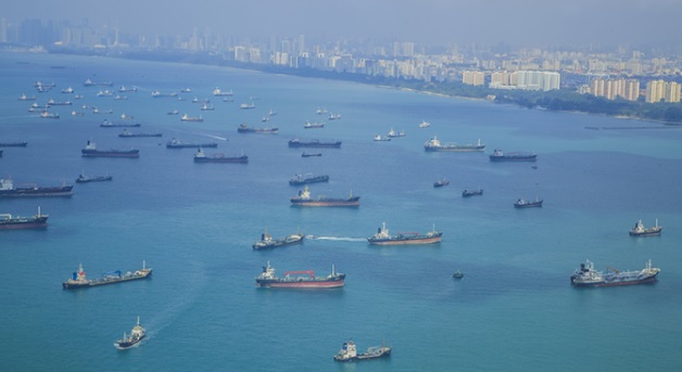
Safety of navigation in congested water: Singapore strait
Ships navigation is referred to the voyage practices, focusing on the process of monitoring and controlling the movement of the ship from point "A" to point "B". Choosing the most optimum route while transiting through traffic-congested water is even more challenging. Specifically, due to the presence of many vessels in the vicinity, a repeated risk of collision exists. Any action to avoid close quarter situation with another vessel is limited due to the existence of a third vessel or proximity of shoal water or other fixed structure, or where such a situation is expected to arise. We have summarized below some critical elements of navigation in congested water.
The Singapore Strait is a narrow and busy waterway where a large number of
vessels transit daily. These vessels include bulk carriers, container vessels, ferries,
tankers, very large crude carriers (VLCC), barges under tow and fishing vessels. In
the interest of navigational safety, shipmasters of vessels navigating in the
Singapore Strait are reminded to observe the International Regulations for
Preventing Collisions at Seas (COLREGS) and the “Rules for Vessels Navigating
Through The Straits of Malacca and Singapore” adopted by the IMO.

Singapore strait traffic
To enhance navigational safety, the Singapore Vessel Traffic Information
System (VTIS) constantly monitors vessel movements in the Singapore Strait and
provides traffic information and advice to shipmasters to enable them to appraise
the traffic situation. The Singapore VTIS has observed that reducing the vessel's speed
is an action not commonly taken and would like to remind shipmasters of the
following rules concerning actions on speed of vessels:
- International Regulations for Preventing Collisions at Sea, 1972
Rule 6 dictates:
"Every vessel shall at all times proceed at a safe speed so that she can
take proper and effective action to avoid collision and be stopped within a
distance appropriate to the prevailing circumstances and condition.
In determining a safe speed, the following factors shall be among those taken
into account:
- (a) By all vessels:
(i) the state of visibility;
(ii) the traffic density including concentrations of fishing vessels or
any other vessels;
(iii) the maneuverability of the vessel with special reference to
stopping distance and turning ability in the prevailing conditions;
(iv) at night the presence of background light such as from shore
lights or from backscattering of her lights;
(v) the state of wind, sea and current, and the proximity of
navigational hazards;
(vi) the draught concerning the available depth of water.

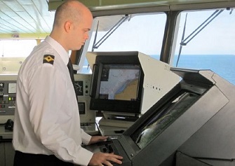
Radar navigation
- (b) Additionally, by vessels with operational radar:
(i) the characteristics, efficiency, and limitations of the radar
equipment;
(ii) any constraints imposed by the radar scale in use;
(iii) the effect on radar detection of the sea state, weather and
other sources of interference;
(iv) the possibility that small vessels, ice, and other floating objects
may not be detected by radar at an adequate range;
(v) the number, location, and movement of vessels detected by
radar;
(vi) the more exact assessment of the visibility that may be
possible when the radar is used to determine the range of vessels
or other objects in the vicinity.
- Rule 8 (e): If necessary to avoid a collision or allow more time to assess the
the situation, a vessel shall slacken her speed or take all way off by stopping or
reversing her means of propulsion.
ii) Rules for Vessels navigating through the Straits of Malacca and
Singapore
- Rule (7): VLCCs1 and deep draught vessels navigating in the Straits of
Malacca and Singapore shall, as far as it is safe and practicable, proceed at a
speed of not more than 12 knots over the ground in the following areas:
(a) At One Fathom Bank traffic separation scheme;
(b) Deep-water routes in the Phillip Channel and Singapore Strait; and
(c) Westbound lanes between positions 01° 12.51'N, 103° 52.15'E and
01° 11.59'N, 103° 50.21'E and between position 01° 11.13'N, 103° 49.08'E and
01°08.65’N,103°44.30’E.
- Rule 8: All vessels navigating in the routing system of the Straits of Malacca
and Singapore shall maintain at all times a safe speed consistent with safe
navigation shall proceed with caution and shall be in a maximum state of
maneuvering readiness.
The OOW must always be aware of the possibility of navigation in congested waters. If the vessel is expected to navigate such areas, he must take the following action:
- Early evacuation from the congested area, if possible.
- Arrangement of Lookout(s).
- Report to the Master.
- Test of manual steering or changeover to manual steering.
- Contact with Engineers, if necessary
- Reduction to a safe speed, if required.
- Running in Parallel of Power units of Steering gears.
Action of the masters in congested waters :
When, when the vessel is in congested water upon receiving the report from the OOW, the Master above, must confirm the situation and increase officers or ratings for lookout as required. He shall take over the command of the vessel.
Action of the Master and officer of the watch in restricted visibility conditions :
If the vessel encounters congested waters under restricted visibility conditions, the Master and OOW must navigate the vessel carefully according to the provisions of the "Procedures for Navigation in Restricted Visibility Conditions" in addition to those outlined above.
A comprehensive passage plan to be
available for the voyage and it
cover the full voyage from berth to berth.
Notes: The following should be marked on the
chart, where it enhances safe navigation:
- Parallel indexing (not from floating objects);
- Chart changes;
- Methods and frequency of position fixing;
- Prominent navigation and radar marks;
- No-go areas;
- Landfall targets and lights;
- Clearing lines and bearings;
- Transits, heading marks and leading lines;
- Significant tides or current;
- Safe speed and necessary speed alterations;
- Changes in machinery status;
- Minimum under keel clearance;
- Positions where the echo sounder should be
activated;
- Crossing and high density traffic areas;
- Safe distance off;
- Anchor clearance;
- Contingency plans;
- Abort positions;
- VTS and reporting points, etc.
Related Information
Notable areas of congested water
Navigational procedures for ship in confined water
Collecting Information and Data for Passage Planning
Safety of navigation for containership
What are the steering gear check item ?
....
How to avoid navigation in heavy weather ?
....
What are the conditions that should be reported to master while navigating ship ?
....
What are the safe navigational procedure for the officer of the watch ?
....
How to deal with engine or steering gear trouble
?
....
What is gyro failure and countermeasures
?
....
How to respond with engine trouble
?
....
How to deal with ships collision accident
?
....

Other info pages !
Ships Charterparties Related terms & guideline
Stevedores injury How to prevent injury onboard
Environmental issues How to prevent marine pollution
Cargo & Ballast Handling Safety Guideline
Reefer cargo handling Troubleshoot and countermeasures
DG cargo handling Procedures & Guidelines
Safety in engine room Standard procedures
Questions from user and feedback Read our knowledgebase
Home page

ShipsBusiness.com is merely an informational site about various aspects of ships operation,maintenance procedure,
prevention of pollution and many safety guideline. The procedures explained here are only indicative,
not exhaustive in nature and one must always be guided by practices of good seamanship.
Site Use and Privacy - Read our privacy policy and site use information.
//Home //Terms and conditions of use
Copyright © shipsbusiness.com All rights reserved.


